UN
2 Cross Road
£ 405,000
Description
We don't have a Description for this property.
- Bedrooms
- 3
- Bathrooms
- 0
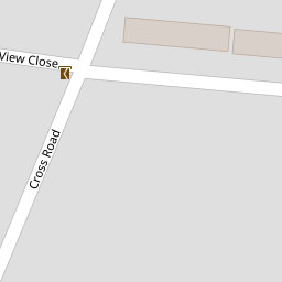


Leaflet © OpenStreetMap contributors
The heatmap indicates the level of crime in the area. The color of the heatmap indicates the crime severity and recency.
Metrics Year-on-Year
- Average area value
- 450,015.00 £Increased by 11.82 %
- Average area rental value
- 1,360.00 £/moDecreased by 3.41 %
- Est rental Yield
- 3.63 %Decreased by 13.57 %
- Crime Rate
- 6.00 %Unchanged by 0.00 %
from 402,439.00 £
from 1,408.00 £/mo
from 4.20 %
from 6.00 %
Nearby Schools
| Name | Type | Ofsted | Distance |
|---|---|---|---|
| Crownfield Infant School | Community School | Good | 0.86 KM |
| Crownfield Junior School | Community School | Good | 0.86 KM |
| St Edward'S Church Of England Academy | Academy Sponsor Led | 1.28 KM | |
| St Patrick'S Catholic Primary School | Voluntary Aided School | Good | 1.41 KM |
| Crowlands Primary School | Community School | Good | 1.50 KM |
Images
Nearby Streets
| Name | Average Price | Average Sqft | Distance |
|---|---|---|---|
| Pitcairn Close | £ 0 | 0 | 0.00 KM |
| Eastern Avenue West | £ 0 | 0 | 0.00 KM |
| Gordon Road | £ 0 | 0 | 0.00 KM |
| Cavendish Gardens | £ 450,000 | 0 | 0.00 KM |
| Adams Close | £ 550,000 | 0 | 0.00 KM |
Nearby Transport
| Name | NLC | TLC | Distance |
|---|---|---|---|
| Romford | 6886 | RMF | 3.25 KM |
| Chadwell Heath | 6874 | CTH | 3.43 KM |
| Goodmayes | 6878 | GMY | 5.34 KM |
| Gidea Park | 6877 | GDP | 5.60 KM |
| Dagenham Dock | 7440 | DDK | 6.54 KM |
Nearby Listings
| Address | Price | Type | Score | Distance |
|---|---|---|---|---|
| Marlborough Road, Romford, RM7 | £ 425,000 | BUY | 6 / 10 | 0.10 KM |
| Pitcairn Close, Romford | £ 425,000 | BUY | 6 / 10 | 0.11 KM |
| Cross Road, Mawneys, Romford, RM7 | £ 600,000 | BUY | 7 / 10 | 0.13 KM |
| Marlborough Road, Romford, RM7 | £ 499,999 | BUY | Unknown | 0.14 KM |
| Cross Road, Mawneys, Romford, RM7 | £ 425,000 | BUY | 7 / 10 | 0.26 KM |
Nearby Properties
| Address | Price | Distance |
|---|---|---|
| 7 Cross Road | £ 310,000 | 0.00 KM |
| 9 Cross Road | £ 180,000 | 0.00 KM |
| 11 Cross Road | £ 215,000 | 0.00 KM |
| 13 Cross Road | £ 288,000 | 0.00 KM |
| 2 Cross Road | £ 405,000 | 0.00 KM |